In the sixteenth century, establishing a thriving city in the arid region now known as Chhatrapati Sambhajinagar presented a formidable challenge. Water scarcity limited settlement potential, with locals relying solely on sources such as the Kham River, Rajtadag reservoir and old wells. Recognising this obstacle as he set to establish Khadki as a new capital city of the Ahmadnagar Sultanate, Malik Ambar conceived a solution that would transform the landscape of the region forever.
Ambar envisioned harnessing distant water sources through a sophisticated system of nahars (canals) and bambas (aqueducts) to nurture his growing city—reflecting the pinnacle of medieval hydraulic technology. Among the nahars, the Nahar-e-Ambari remains a distinctive historical feature of the city, with remnants still visible throughout the old quarters of Chhatrapati Sambhajinagar. While the city once boasted several independent nahars—including Thatte Nahar, Panchakki Nahar and Palshi Nahar—only the Panchakki Nahar remains operational today.
The engineers behind these systems brilliantly exploited the natural topography, using the hills’ gradual descent to channel water through large stone or clay pipes and into collection reservoirs. At strategic intervals, they erected elevated aqueducts called bambas that served multiple crucial functions: maintaining optimal water pressure, allowing sunlight and air to purify the flow, and enabling access for maintenance. From the street level, these underground waterways remain virtually invisible—a testament to their ingenious design. Though urban expansion has claimed many of the original bambas, the ten magnificent structures of Thatte Nahar in Begampura still stand.
Nahar-e-Ambari: Ambar’s Legacy
Malik Ambar initiated the construction of the nahar alongside the development of the Naukhanda Palace in 1604, largely completing this monumental project by 1610. The system channelled water from the Sawangi Hills to Roza Bagh through an underground channel before distributing it across the city via a network of earthen pipes. To regulate pressure and ensure efficient flow, elevated bambas were strategically placed along the route.
The waterways were directed to key civic and royal locations—Naukhanda Palace, Gulshan Mahal, Town Hall, Shahgunj, Lotakaranja, Qile-e-Ark and various parts of the old market. However, much of this intricate water supply system has been lost due to the passage of time, neglect and urban development. Today, only scattered bambas, occasional fountains and a few ancient tanks remain as silent witnesses to Ambar’s visionary achievement.
Panchakki: The Historic Water Mill
Panchakki, literally meaning ‘water mill’, is situated within the complex that also houses the dargah dedicated to Hazrat Baba Shah Musafir, a revered Sufi saint and spiritual guide to Mughal Emperor Aurangzeb. The Panchakki complex once served as a sanctuary that provided refuge and sustenance to saints, pilgrims and soldiers alike.
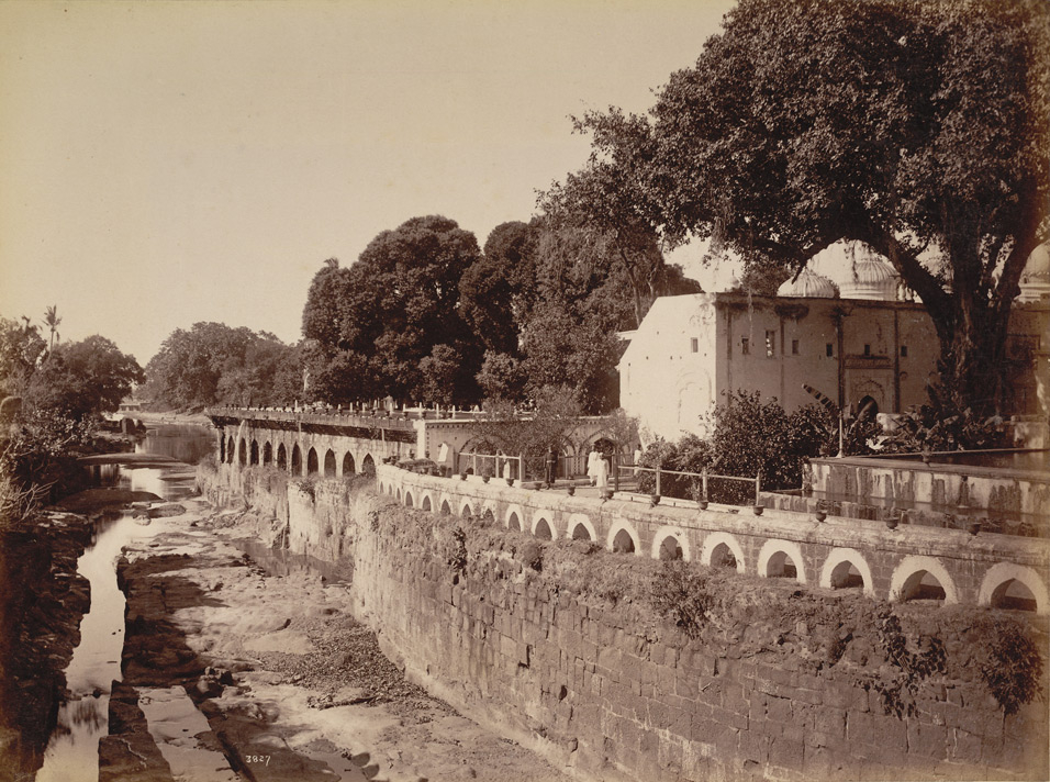
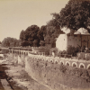
Panchakki by Raja Deen Dayal. (Picture Source: Wikimedia Commons)
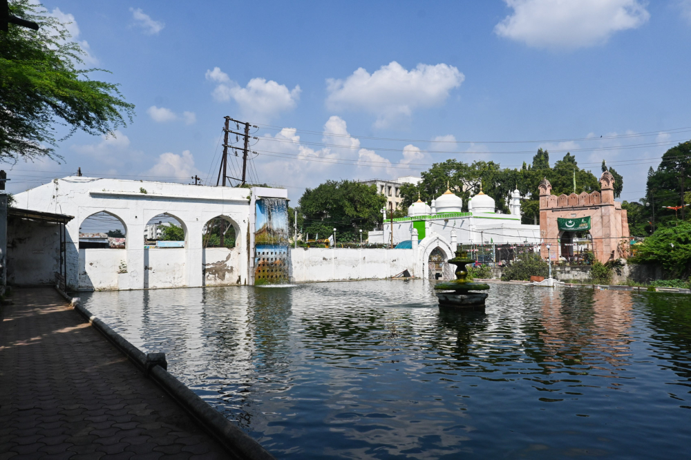
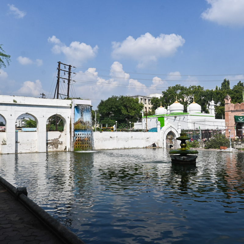
View of the pool in the Panchakki complex. In the distance is Mahmud Darwaza and the domed Jamil Baig masjid. (Picture Credits: Anil Purohit)
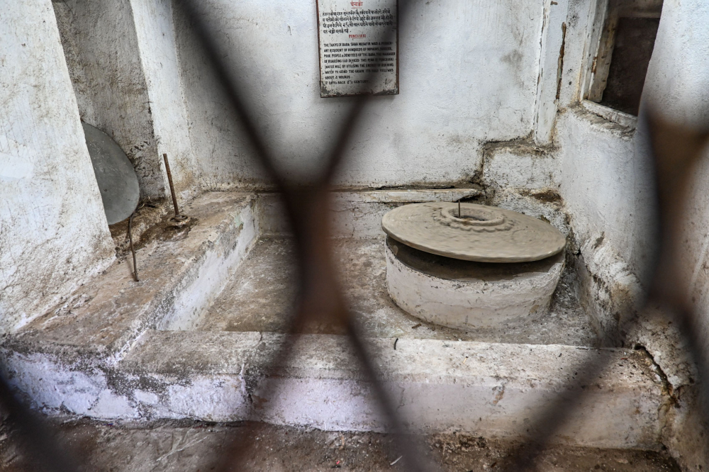
Water rotates the blades of the water mill. (Picture Credits: Anil Purohit)
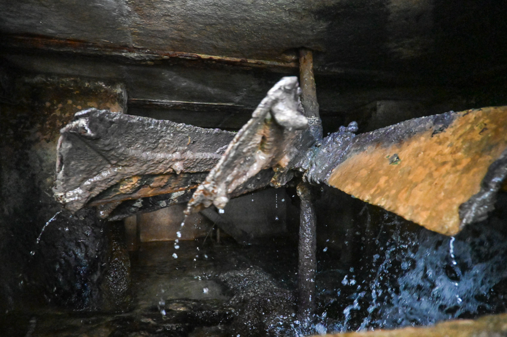
Water mill. (Picture Credits: Anil Purohit)
Built in 1744, the water mill was designed to grind grain for the local populace and soldiers of Aurangzeb’s army. Water from a spring on the Jatwada Hills, flowing through the Harsul River, was raised using a siphon system into an earthen pipe before travelling an impressive 6 kilometres down to the mill. Originally, this system not only powered the grain mill but also supplied water to the complex’s fountains and pools. Despite centuries of use, the water mill is still functional without human intervention. Though designated a protected monument under the state archaeology department today, the water mill is currently managed by the Waqf Board.
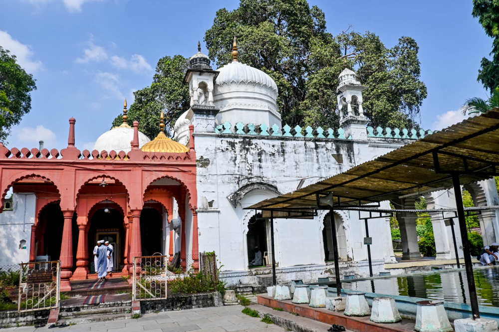
View of the Dargah of Baba Shah Musafir. A mosque adjoins the Dargah. (Picture Credits: Anil Purohit)
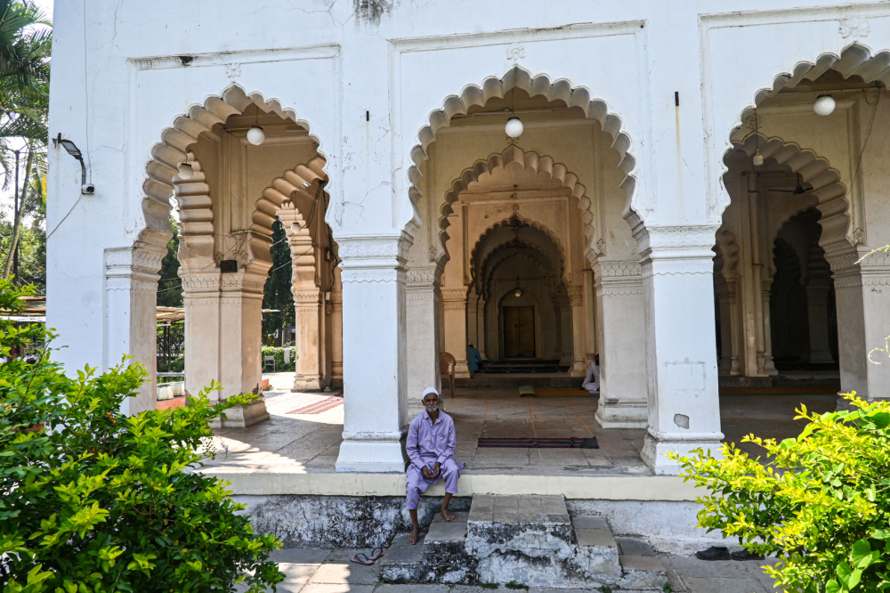
Mosque in the Panchakki complex. (Picture Credits: Anil Purohit)
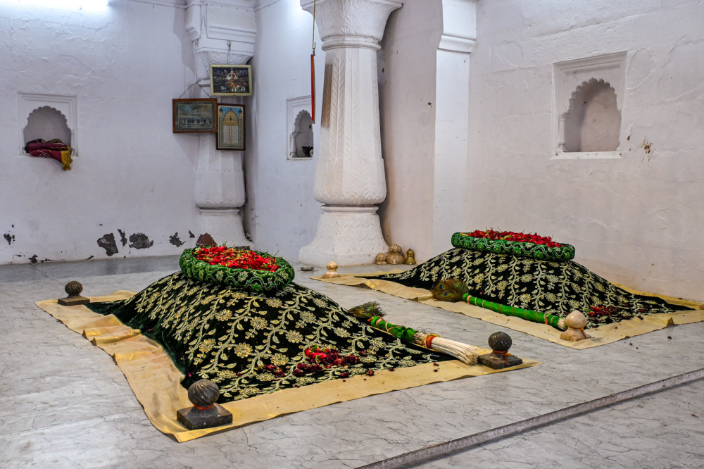
Interior view of the Dargah of Baba Shah Musafir. (Picture Credits: Anil Purohit)
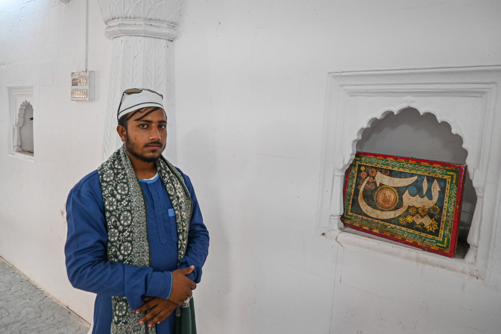
Caretaker at the Dargah of Baba Shah Musafir. (Picture Credits: Anil Purohit)
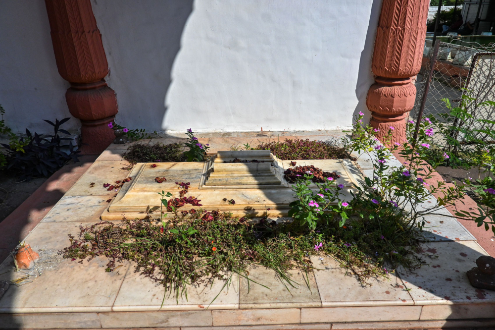
Tomb in the Dargah of Baba Shah Musafir. (Picture Credits: Anil Purohit)
Other than the mill and dargah, the Panchakki complex also houses the tomb of Baba Shah Mahmood alongside a mosque, madrasa, court, traveller lodgings, women’s quarters and several monuments. The main structures were built around 1695 by Turktaz Khan, a noble in the court of Nizam-ul-Mulk Asaf Jah, while Jamil Beg Khan, a disciple of Baba Shah Musafir, expanded the site two decades later, adding a large reservoir in front of the mosque and the fountains that are still part of the site. A large banyan tree near the tank provides shade to pilgrims and visitors and the historic Kham River flows nearby.
Beyond its architectural and spiritual significance, the Panchakki complex houses the headquarters of the Maharashtra Waqf Board and an eighteenth-century library containing rare manuscripts and books on history, law and philosophy. Following years of closure, the library has reopened its doors, offering researchers and students access to its treasured collection.
Thatte Nahar and Other Important Nahars
Constructed approximately 250 years ago during the Asaf Jahi period, Thatte Nahar’s intricate water system originates in the hills of Ohar-Jatwada, flowing through areas near Himayat Bagh before reaching the Thatte Haud (reservoir) in Begampura via a network of 10 bambas. One branch of this nahar extended to a tank in front of Bibi ka Maqbara. The Thatte family initially maintained this vital infrastructure before transferring stewardship to the Archaeological Survey of India with the intent of ensuring proper preservation. Unfortunately, recent decades have seen diminished protection for this historical treasure.
Some of the other nahars that played a crucial role in water management in this region include:
-
Nahar-e-Palshi: Partially intact, with visible bambas near Pisadevi and Pardeshwar Temple.
-
Nahar-e-Garkheda: Once an important conduit but no longer in existence.
-
Nahar-e-Satara: Fragments of its bambas and earthen pipes can still be found in the Satara district.
-
Shah Ali Nahar: Remnants of its bambas can be spotted near Shahnoor Miyan Dargah and along the Osmanpura police station road.
Despite the gradual decline of many of these historic water systems, iconic sites like the Panchakki complex continue to attract visitors from around the world, offering a fascinating glimpse into seventeenth-century engineering marvels. Preserving these structures serves not merely to honour medieval ingenuity but also to inspire contemporary approaches to sustainable water management in an increasingly water-stressed world.
This essay has been created as part of Sahapedia's My City My Heritage project, supported by the InterGlobe Foundation (IGF).
